seatheory
Vessel Quick Reference Handbook

The pilot's checklist, written for your boat.

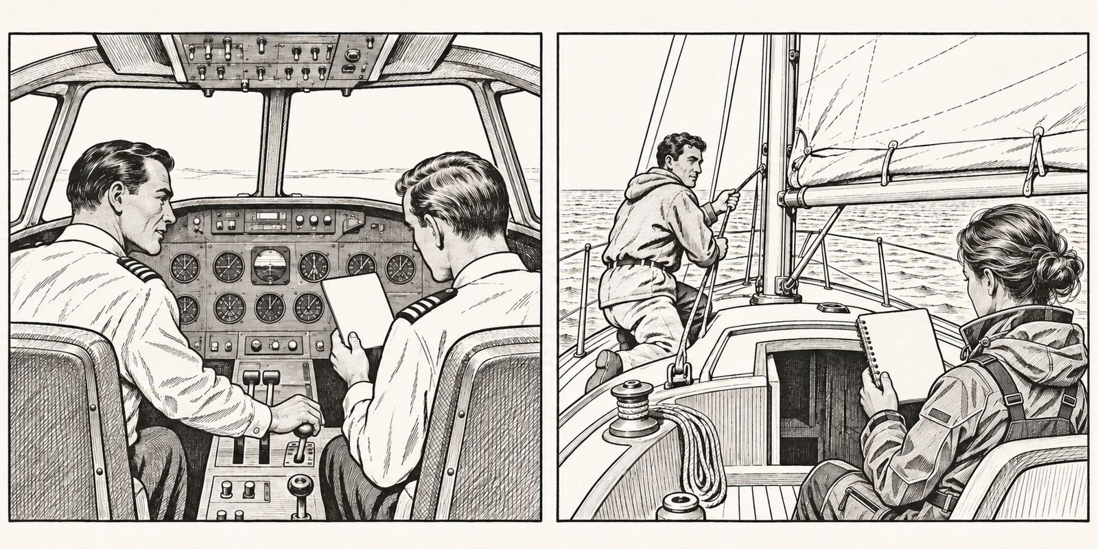
Two matching drawings. Left: in an airliner cockpit, the first officer reads a checklist while the captain works the controls. Right: on a sailboat, the skipper in the cockpit reads a small coil-bound checklist while a crew member at the mast hauls on a reef line.
QRH · AIRCRAFTFLAPS — TWO
VQRH · YOUR BOATREEF LINE ONE — TIGHT

Airline crews don't work problems from memory. One reads the checklist and the other confirms each item.

The Vessel Quick Reference Handbook (VQRH) brings that discipline aboard. Our AI interviewer walks through your boat one question at a time and writes a handbook of procedures made just for her. Everyday sailing, and the day something goes wrong.

Try out our AI interviewer:Get your free MAYDAY Card

Plenty of books about sailing.
One about your boat.

Note A

The seaTheory Library

A curious collection of old sailing books and magazines.

Seamanship manuals, navigation texts, voyages, sea fiction and vintage yachting magazines. Over a thousand of them, free to read, and mostly for the fun of it.

140BOOKS
1,026MAGAZINE ISSUES
Note B

Your boat's handbook

Start with her free MAYDAY Card.

An AI interviewer asks about her, one question at a time, and writes her MAYDAY Card: the first two pages of her handbook, and the ones you'd need most.

  1. 01Answer a few questions about her, typed or spoken.
  2. 02Get her MAYDAY Card: the call on the front, position and vessel ID on the back.
  3. 03Print them and keep them by the VHF.
Week of November 16, 2026

Dispatches

Cruising news, weekly.

Ten days before the official end of the Atlantic hurricane season, forecasters are watching a low near the northwest Bahamas that could become a subtropical or tropical storm off the US Southeast coast this weekend. The ARC+ fleet is at sea for Cape Verde and the main ARC fleet leaves Las Palmas for Saint Lucia on Sunday. Off the Outer Banks, two sailors were lifted from a grounded, flooding boat at Oregon Inlet.

Summaries in our own words, each linked to the original report as it stood when reported. Not a forecast: for weather, see the National Hurricane Center and Environment and Climate Change Canada.

Weather

Possible storm off the Southeast coast this weekend

A low forming near the northwest Bahamas may turn subtropical or tropical as it moves north near or off the coast from Saturday; it would be named Kyle. Not a crossing window. Follow the National Hurricane Center for the official outlook.

The Weather Channel, Nov 19, 12:55 pm EST · Read the report · NHC outlook

King tide adds to coastal flooding risk

The full moon on Tuesday, Nov 24, may compound high-tide flooding from Tidewater Virginia to New England if the low tracks close.

The Weather Channel, Nov 19 · Read the report

Hurricane season ends Nov 30, officially

NHC's routine outlooks run to the end of the month. Late systems like this week's are a reminder that the date is a convention, not a guarantee.

National Hurricane Center, Tropical Weather Outlook · Read the report

Where the fleet is

ARC+ at sea for Cape Verde

78 boats left Las Palmas on Nov 12, four days late because of southerlies, bound for Mindelo and then Grenada. The restart from Mindelo is set for Nov 22.

Caribbean Compass, Nov 13 · Read the report

ARC starts Sunday

The main fleet leaves Las Palmas de Gran Canaria for Rodney Bay, Saint Lucia, on Nov 22. First arrivals usually reach Rodney Bay in early December.

World Cruising Club, Event page · Read the report

Salty Dawgs add a Montserrat stop

The first Salty Dawg Rendezvous runs Nov 28 to Dec 1 at Little Bay. Pre-clear through SailClear and bring your own ground tackle; there are no moorings.

Caribbean Compass, Nov 18 · Read the report

Rules & paperwork

Bahamas permits: no change since April

The 30-day and 6-month cruising permits restored on April 1 remain current, and marina-docked boats are exempt from the anchorage fee. Confirm with Bahamas Customs before you cross.

Power & Motoryacht, Sept 22 · Read the report

US arrivals: ROAM, not SVRS

CBP says the old Small Vessel Reporting System is no longer in service. Report through the CBP ROAM app or by phone.

US Customs and Border Protection, Pleasure boat reporting page · Read the report

Safety & advisories

Hormuz threat still rated severe

The Joint Maritime Information Center's latest update logs five attacks on tankers and two armed-skiff approaches since its previous report, several near Khasab, Oman. No attribution has been published.

Gulf News, Nov 20 · Read the report

Armed skiff approach east of Socotra

UKMTO reported a tanker approached by a skiff with four armed people and a ladder about 430 nm east of Socotra on Nov 16. No boarding.

Palaemon Maritime, Nov 16 · Read the report

Casualties

Two lifted from grounded sailboat at Oregon Inlet, NC

The sailboat Spirit Watcher grounded on the south side of the channel on the night of Nov 15 and began taking on water. A Coast Guard helicopter hoisted both men early Nov 16; no serious injuries were reported. Early report.

Outer Banks Voice, Nov 16 · Read the report

Keep the words by the radio: the free MAYDAY Card

Southbound sailboat towed in off Cape Hatteras

Esprit, bound from the Chesapeake for Puerto Rico, reported a torn sail, no fuel and failed electronics about 28 nm east of Cape Hatteras on Nov 14 and was towed to Hatteras Landing on Nov 15. No injuries.

WAVY via Yahoo News, Nov 20 · Read the report

Publication ST 201 · Free

Radio Frequency Atlas

What you will hear on the air, afloat.

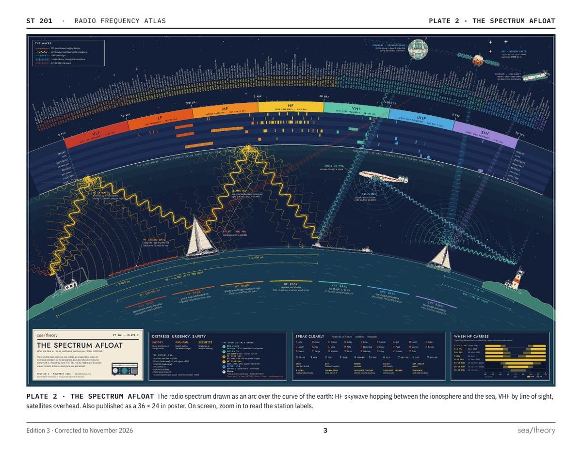
Every frequency a sailor is likely to tune, set out the way a chart is: marine VHF and HF, weather, time signals, shortwave broadcasters, amateur bands and Winlink, aviation, satellites and direction finding. Each section opens on a strip of the spectrum, and Plate 2 lays the whole of it out at once. With repeaters and local stations for Lake Ontario.

34PAGES
14SECTIONS
3 kHzTO 30 GHz

We keep your email to send the atlas and, only if you tick the box, our notes. We don't sell or share it, and every email has links to unsubscribe or delete it. Privacy

Edition 3 · corrected to November 2026 · An independent publication of sea/theory, not issued by any government agency. A listing is not authority to transmit.
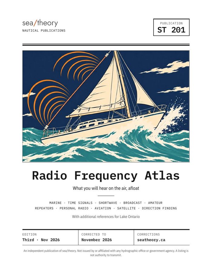
Cover of the Radio Frequency Atlas, ST 201: a sailing ship drawn in line, under radio waves.
COVER
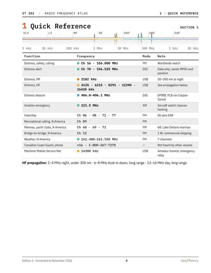
Section 1, Quick Reference: distress and calling channels in a table under a spectrum strip.
1 · QUICK REFERENCE
Plate 2, The Spectrum Afloat: the radio spectrum drawn as an arc over the curve of the Earth.
PLATE 2 · THE SPECTRUM AFLOAT
Note C · in preparation

The full handbook

Every procedure for your boat, about 60 pages, coil bound to lie flat at the chart table. Your MAYDAY Card is its first two pages.

TABSECTIONCONTENTS
DDistressThe MAYDAY call, position and vessel ID, abandoning ship.
NNormalDeparture, sails, the engine, anchoring and securing her.
AAbnormalThings going wrong before they become emergencies.
EEmergencyFire, flooding, crew overboard and the rest.
RReferenceCode flags, lights and shapes, rules of the road, the chart table.